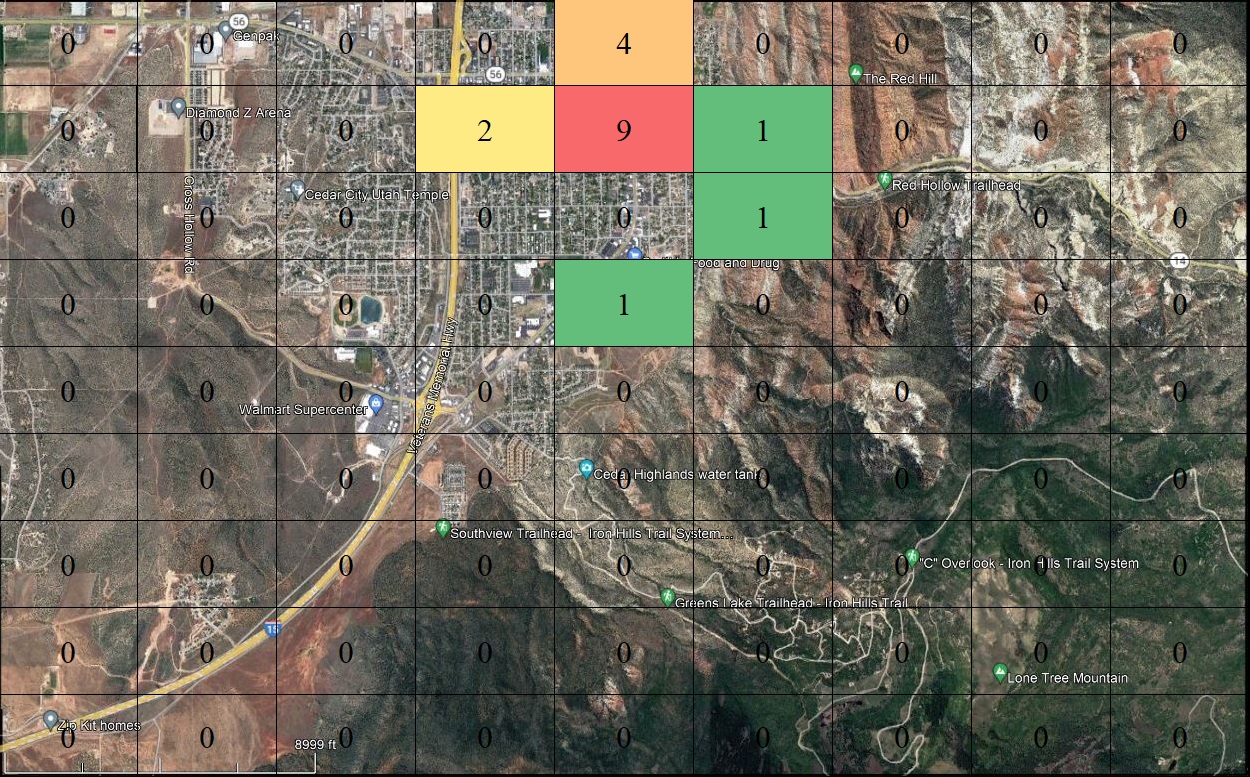
This IG4-26572183 map of Cedar City, Utah is overlaid with 9×9 IG5 cells (50”x25” each). Each cell has the number of monuments documented within the cell. The bottom green colored cell, IG5-2657218356, has 1 monument, The Old Brickyard, which is described when the link over that cell is selected. Once again, in the final product each cell location will be an active cell, and can be selected to zoom into a smaller area, or to select the spatial search criteria.